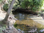
 Water resource management issues within the East County Water Control District (ECWCD) effects on man-made and natural systems and communities on and offsite (including the Caloosahatchee River, Orange River, Hickey’s Creek, Bedman Creek, Estero River and Imperial River ) were poorly understood. The ECWCD, composed primarily of Lehigh Acres, comprises the headwaters of the aforementioned streams, rivers and sheet flow areas in addition to providing substantial recharge to the sandstone aquifer. Historical drainage activities have compromised the hydrological and ecological functions provided by this area of approximately 100,000 acres.
From 2005 through early 2009 Kevin Erwin Consulting Ecologist, Inc. (KECE) worked with the ECWCD engineer, AIM Engineering, to provide ecological services to the ECWCD in developing the Lehigh Headwaters Initiative (Initiative). The Initiative was developed by KECE as part of the initial scope for this project, approved by AIM Engineering in 2006. KECE developed and implemented a methodology to model the existing and historical (NSM) water management system using the MikeShe model. Hydrological improvements are now being augmented with the ecological data provided by KECE. This data is now being utilized to develop and guide future modeling, planning and design objectives, minimizing environmental impacts and identifying opportunities for restoration and enhancement of natural resources within and adjacent to the ECWCD. KECE was able to determine the natural extent of flooding of downstream tributaries and a number ecological engineering designs and projects that would increase storage, improve water quality and restore downstream base flows.
KECE defined the spatial limits of the ecological evaluation study area, which also included areas outside the ECWCD; the Orange River, Hickey’s Creek, Bedman Creek watersheds and lands south of Halfway Pond/Mirror Lakes and SR.82. The historic and present watershed boundaries of the headwaters area were also determined and defined the scope of ecological evaluations to be undertaken within the ECWCD and within the downstream watersheds and streams. This activity has already resulted in the successful monitoring and evaluation of the Orange River, Harns Marsh, and Hickey’s Creek watersheds and also includes monitoring within systems such as the Orange River, Harns Marsh and the Hickey’s Creek/Greenbriar Swamp complex.
KECE prepared Level 4, Florida Land Use and Cover Classification System (FLUCFCS) maps for the undeveloped lands within the entire study area. This continuing effort provided critical guidance and recommendations relative to future land acquisition scenarios to the ECWCD, Lee County, Florida Department of Environmental Protection, South Florida Water Management District and the US Army Corps of Engineers. The effort in the Hickey’s Creek watershed has resulted in the identification of potential ROMA (Regional Offsite Mitigation Area) concepts and opportunities for redirecting, storing and treating surface water flows. Within the Orange River watershed, mapping has identified opportunities for expanding and redesigning Harns Marsh (Phase I now complete) with the goal of improving base flows and attenuating storm flows on the Orange River where residents had been subject to regular flooding in the past. KECE determined recent and historic normal seasonal high water levels in wetlands, historic wetlands and streams within the study area to provide data input to the MikeShe model and identified opportunities and constraints for future water management objectives including water storage, water quality improvements and wetland restoration. KECE also evaluated ongoing water quality monitoring being done by several agencies, designed and implemented one master monitoring plan now being cooperatively implemented by the same agencies.