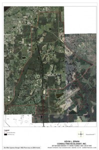
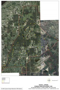
Long Term Ecological Monitoring of the Six Mile Cypress Slough and Watershed
 As recently as the 1970’s, Six Mile Cypress Slough (SMCS) was a relatively remote and unimpacted 2,200 acre slough in rural Lee County southeast of Ft. Myers. Although the SMCS has remained largely intact, land development and water management activities have reduced the historical 57 square mile watershed to 32.6 square miles (KECE 2006). Therefore the role SMCS serves as vital habitat and nursery areas for native species has become critical. It currently provides habitat for many species including 13 listed as endangered, threatened or of special concern (Lee County Parks and Recreation 2002).
Although Lee County and the South Florida Water Management District (SFWMD) now own the majority of lands within SMCS, others control much of the remaining watershed. Habitats present in the watershed include native uplands, wetlands, and most importantly, the headwaters that sustain the slough. These areas represent an uncontrollable factor in supporting the natural hydrology of the watershed.
A recent study concluded that the SMCS is ecologically impacted, and that current hydropatterns will not sustain existing cypress or swamp forest communities (Murray et al. 2004). With continued impacts to the SMCS watershed, it is likely that the ecological services and function of the natural communities within the slough will continue to decline.bIn order to protect the ecological integrity of this valuable resource, it is imperative that flooding duration and intensity within SMCS are restored to natural levels. However, this can only be accomplished once current hydrological conditions are accurately measured and correlated with the existing flora and faunal communities. KECE conducted a baseline survey for hydrology, vegetative community structure, fish and macro-invertebrates within SMCS beginning June 2006 and ending September 2006.
The implementation of a Long Term Ecological Monitoring Plan (LTEMP) will:
- construct a detailed ecological history of the Slough and its watershed;
- provide an accurate predictive hydrological model;
- provide a conceptual ecological model;
- provide data for determining long term ecological and hydrological trends and
- identify targets and processes for ecological restoration, resource management and sustainability.
Long-term studies are required to separate the effects of natural climate-induced fluctuations in biotic communities, such as amphibian populations from human-induced population declines. The focus of the LTEMP includes the slough and its watershed. The plan is to obtain a long term commitment from the SFWMD and commence development of the monitoring network in January 2006. The LTEMP would be implemented by a partnership of private, non-profit, academic and government institutions staffed by scientists, volunteers and university students. The monitoring plan focuses on hydrology (ground and surface water), vegetation (native and exotic), water quality, biological integrity, soils, fish and wildlife. Monitoring these parameters will allow a real time assessment of the condition of ecological resources and functional capacity of the natural and man-made systems within the study area.
Biological data measure the health of ecosystems consisting of aquatic and terrestrial communities. Biological data include counts of aquatic species that indicate healthy aquatic conditions. Biocriteria are currently being incorporated into water quality standards to extend the protection offered by traditional chemical water quality criteria for non-chemical stresses to aquatic communities. While chemical and physical data may be used to predict poor and uninhabitable conditions, neither is a direct measure of ecosystem, community or organismal health. The multitudes of interactions that can occur under varying physical and chemical conditions make it almost impossible to predict the effects of water quality on aquatic life given only physical and chemical data. Biological criteria can provide a direct measure of aquatic health.
It is anticipated that information such as that gathered from the LTEMP will assist environmental managers and decision-makers in understanding ecological function in relation to human influence. Additionally, we expect that LTEM data can be used to develop biological measures or indicators for ecological health and if measured over time, could be incorporated into large-scale trend assessments elsewhere to determine the changing conditions of southwest Florida’s environment.
The overall goal of the LTEMP in the SMCS watershed is:
- to detect changes in particular attributes of the upland and wetland ecosystems and determine if those changes are within the bounds of natural or historic variability;
- to predict how those changes relate to natural processes and human-influences; and,
- to understand how such changes, ultimately, affect the condition of the SMCS.
Detecting, Predicting, and Understanding Change
The aim of the LTEM program at SMCS is:- to validate ecological and hydrological model assumptions and predictions that explain how (and why) changes occur;
- to forecast potentially adverse changes that provide “early warning” capabilities;
- to inform whether and when management intervention is necessary; and
- to evaluate the effectiveness of management, i.e., how well an ecosystem is being sustained in accordance with current management practices and regulatory programs.
Most importantly, the information generated from the LTEM program is intended to assist landowners and resource managers in clarifying and addressing issues as part of the decision-making process.
- Do the observed changes represent current problems or forecast emerging problems that might adversely affect the ecological integrity of the SMCS system?
- Do the problems require immediate action? Can the problems be remedied by management actions?
- Understanding the dynamic nature of the ecosystems and the consequences of human activity is essential for management decision-making aimed to maintain, enhance, or restore the ecological integrity of the SMCS system and to avoid, minimize, or mitigate ecological threats to the system.
While research has identified responses of wetland ecosystems such as the SMCS to particular system impacts (such as increased nutrients or altered hydrology), ecologists have done little to combine multiple biotic components, environmental parameters, and landscape development intensity in an attempt to quantify ecological integrity. For example, decreasing the mean water level could cause changes in the community composition of many species that rely on cypress domes for regeneration. Benthic macroinvertebrates may not withstand increased dry periods, and reproduction may be difficult or unattainable. Macroinvertebrates often form the base of wetland food chains, eliminating or decreasing their populations could have significant repercussions throughout the food chain. Fish, amphibian, and reptile populations may be reduced or eliminated from these wetlands with decreased hydroperiods due to reproduction difficulties or altered food availability.
Ecosystem-Based and Issue-Oriented Monitoring
The approach of the LTEM Plan within the SMCS watershed is an ecosystem-based approach to monitoring coupled with an issues-oriented emphasis. The ecosystem concept recognizes that inevitable changes to the ecosystem result from interactions between biota and the environment operating at many different spatial and temporal scales. Although no one scale is appropriate for monitoring all ecosystem processes or components, characteristic spatial and temporal scales commonly form natural, ecological hierarchies governed or constrained by the physical dimensions of the landscape. While these natural subdivisions are primarily derived from landscape criteria and other environmental dissimilarities, they constitute an ecological setting or context that governs human land use practices and other activities. As such, the ecosystem-based approach uses natural, hierarchical dimensions of the SMCS watershed’s landscape as a suitable template for monitoring changes in ecological phenomena associated with both natural and human causes.
The role of monitoring is crucial in detecting meaningful levels of change from which critical threshold values or policy standards are determined. The emphasis on issues will explore our knowledge of cause-and-effect relations by incorporating two complementary strategies, threat-specific monitoring and effects-oriented monitoring. A presupposition of causality usually supports threat-specific monitoring. Whereas for effects based monitoring, the focus is on tracking trends that are indicative of ecosystem integrity, such as acceptable values of biological diversity or primary productivity. The issue-oriented emphasis combines both threat-specific and effects-oriented monitoring in order to achieve a sufficient level of predictability to better guide management action. Simultaneous monitoring of trends in both ecosystem effects and ecosystem stresses can improve the interpretation of monitoring results.
For additional information on Six Mile Cypress Slough Preserve:
